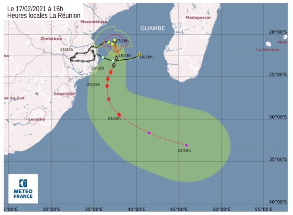
The Path of the Tropical Cyclone Guambe: Satellite Image Map: Tropical Cyclone Guambe, the third tropical cyclone to make landfall in Mozambique since December 2020, followed the paths of Cyclone Eloise and Tropical Storm Chalane. It originated from a tropical disturbance in the Mozambique Channel on 10 February and developed into a subtropical depression two days later, making landfall in Mozambique. Over the following days, Guambe made a clockwise loop over Mozambique, causing widespread rainfall, before re-emerging into the Mozambique Channel on 16 February. Shortly after, it strengthened into a moderate tropical storm and was named Guambe.
The Path of the Tropical Cyclone Guambe: Satellite Image Map
The storm intensified rapidly, achieving tropical cyclone status on 19 February and peaking as a Category 2-equivalent tropical cyclone. Guambe underwent an eyewall replacement cycle and weakened back into a severe tropical storm on 20 February. It then transitioned into an extratropical storm on 22 February before being absorbed into another extratropical cyclone the following day.
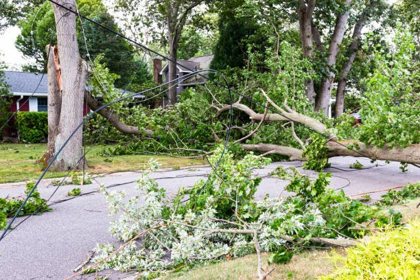
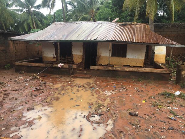
The storm’s precursor disturbance caused widespread flooding across Mozambique upon making landfall on 12 February, destroying homes, crops, and displacing thousands of people. This catastrophe followed shortly after Cyclone Eloise had made a similar impact. The damage from Guambe is estimated to be in the millions of dollars (2021 USD), although no deaths were reported.
Meteorological History
A disturbance developed in the Mozambique Channel between Mozambique and Madagascar on 10 February. Over the next couple of days, the system moved westward, approaching the Mozambique coast while gradually organizing. On 12 February, Météo-France La Réunion noted that the system transitioned into a subtropical depression and made landfall near Inhambane, Mozambique. The subtropical depression moved slowly inland, developing no significant sustained convective activity near the center.
Over the following days, the system made a slow clockwise loop over Mozambique, gradually organizing. By 15 February, the system had turned back eastward and was predicted to re-emerge into the Mozambique Channel. On 16 February, the system re-emerged over warm open water and was designated as Tropical Disturbance 11. The storm then resumed its organization, strengthening into a tropical depression later that day.
On 17 February, the depression strengthened into a Moderate Tropical Storm Guambe, with deep convection enveloping the northern section of the storm. Despite initial limitations on intensification due to a lack of upper-level divergence, Guambe eventually strengthened into a severe tropical storm on 18 February. Over the next several hours, Guambe underwent rapid intensification, developing a well-defined central dense overcast (CDO) configuration. Guambe reached tropical cyclone status on 19 February, with the appearance of a small eye on infrared satellite imagery and a well-defined core structure.
Despite forecasts of further strengthening, Guambe rapidly weakened back to severe tropical storm status on 20 February, due to an eyewall replacement cycle, while the storm began accelerating towards the southeast. Guambe further decayed as its rainbands unraveled and its cloud tops warmed, brought on by high wind shear and cool sea surface temperatures. On 21 February, Guambe began undergoing an extratropical transition, completing it the following day as the storm interacted with the southern jet stream. On 23 February, Guambe was absorbed into another larger extratropical cyclone.
Preparations and Impact
Guambe’s precursor disturbance caused prolific rainfall across Mozambique, leading to widespread flooding and displacing over 27,000 people. The storm washed out two bridges on the Umbeluzi River, flooded hundreds of homes, and destroyed numerous crops. A prison in southern Mozambique transferred 150 prisoners to another facility 80 kilometres (50 mi) away due to the risk of flooding from the storm. The storm struck less than a month after Cyclone Eloise had made landfall near the same place, exacerbating the ongoing crisis in the region.
The storm also caused flooding in parts of northeastern South Africa during this time. As a tropical disturbance, Guambe was responsible for millions of dollars (2021 USD) in damages in South Africa. After Guambe re-emerged into the Mozambique Channel on 16 February and began strengthening, local authorities in Mozambique prepared for the potential of additional flooding, particularly in the region between Beira and Inhambane.
Interestingly, the deaths of 186 Spinner dolphins off of Bazaruto Archipelago National Park were thought to be due to Cyclone Guambe. However, there were no additional reports of damage to human property as Guambe accelerated southeastward.
To summarize, the path of Tropical Cyclone Guambe was a destructive one, causing significant damage in Mozambique and South Africa. The cyclone followed a unique trajectory, making a clockwise loop over Mozambique before re-emerging into the Mozambique Channel and intensifying. Despite the extensive damage and displacement of thousands of people, no fatalities were reported in association with the storm. The response from local authorities and international aid agencies has been crucial in managing the aftermath and aiding in recovery efforts.
Get Free Help for Your Assignment Today
Click the Button Below: