
On this page you will find Geomorphology Geography Grade 11 questions and answers with notes, on pdf downloadable format.
Geomorphology is the study of landforms and landform evolution. The topic traditionally has been studied both qualitatively, which is the description of landforms, and quantitatively, which is process-based and describes forces acting on Earth’s surface to produce landforms and landform change.
Science Direct
Grade 11 Geomorphology
The study of Geomorphology is crucial for understanding the complex processes that shape the Earth’s surface. The Grade 11 CAPS South African curriculum incorporates this essential subject as part of the Geography syllabus, enabling students to gain a deeper appreciation for the natural environment. This article will provide an overview of the five units covered in the Geomorphology section, focusing on the different types of topography and the processes that lead to their formation.
Topography Associated with Horizontally Layered Rocks
The first unit explores the topography associated with horizontally layered rocks, often referred to as ‘sedimentary rocks.’ Students will learn about the formation of these rock layers through the processes of sedimentation, compaction, and cementation. They will study various landforms created by horizontal rock strata, including plateaus, mesas, and buttes. Additionally, the unit will cover the effects of weathering and erosion on these features, with a particular emphasis on the role of water in shaping the landscape.
Topography Associated with Inclined Rock Strata
In Unit 2, the curriculum focuses on the topography associated with inclined rock strata. Students will learn about the forces that cause rocks to become tilted, folded, or faulted, leading to the formation of distinctive landforms such as ridges, valleys, and synclines. They will also explore the impact of differential erosion on these features, which results from the varying resistance of rock layers to weathering and erosion.
Topography Associated with Massive Igneous Rocks
The third unit delves into the topography associated with massive igneous rocks. Students will learn about the formation of these rocks through the cooling and solidification of magma or lava. They will explore the differences between intrusive and extrusive igneous rocks and study the formation of various landforms, such as volcanic cones, domes, and batholiths. Furthermore, the unit will discuss the role of tectonic activity in the formation of these features.
Slopes
The focus shifts to the study of slopes, which play a significant role in shaping the Earth’s surface. Students will learn about the factors that determine slope angle, such as rock type, climate, and vegetation. They will also explore the processes that contribute to slope development, including weathering, erosion, and mass movement. Moreover, the unit will discuss the different types of slopes, such as convex, concave, and straight slopes, and their implications for the surrounding environment.
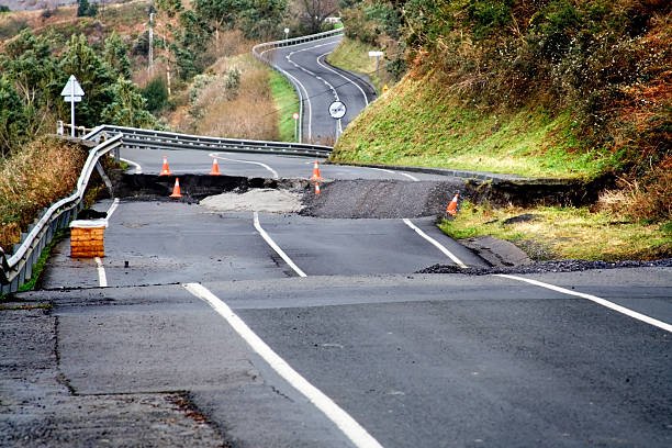
Mass Movements and Human Responses
The final unit addresses mass movements and human responses to these natural events. Students will learn about the various types of mass movements, including rock falls, landslides, and debris flows. They will study the factors that contribute to mass movement events, such as slope instability, weathering, and human activity. Lastly, this unit will cover the strategies used by communities and governments to mitigate the risks associated with mass movements, including land-use planning, engineering measures, and public awareness campaigns.
The Geomorphology section of the Grade 11 CAPS South African curriculum provides students with a comprehensive understanding of the Earth’s surface processes and landforms. By studying the different types of topography and the forces that shape them, students gain valuable insights into the natural world and the human-environment relationship. This knowledge is essential for addressing the challenges posed by climate change, natural disasters, and sustainable development.
Geomorphology Grade 11 Learning Outcomes Summary
Geomorphology Grade 11 Learning Outcomes
In Grade 11 Geography, students will explore the fascinating field of geomorphology. This section covers a range of topics, which are outlined below:
- Time Perspective in Geomorphology: Students will learn about the significance of time in understanding geomorphological processes and how it impacts the Earth’s surface.
- Internal Forces: Students will delve into the various internal forces that shape the Earth, including:
- Plate tectonics, faulting, and the landforms that result from these processes.
- Earthquakes and volcanism, as well as their impact on the Earth’s surface.
- Human responses to the hazards and opportunities presented by these internal forces.
- External Forces: The course will also examine the external forces that influence the Earth’s surface, such as:
- Weathering and erosion, and the processes responsible for shaping the Earth’s surface.
- The influence of weathering and erosion on human activities.
- The importance of the landforms that result from these processes.
- The positive and negative impacts of human activities on weathering and erosion processes.
- Rock Types, Formations, Characteristics, and Uses: Students will study various rock types, their formations, characteristics, uses, and the landforms associated with them. This will give them a deeper understanding of the Earth’s geology and how it influences the landscape.
Questions and Answers
Multiple Choice Exam Preparation Questions on Geomorphology Grade 11
What type of topography is associated with horizontally layered rocks?
- a) Mountains and ridges
- b) Plateaus and mesas
- c) Valleys and canyons
- d) None of the above
Answer: b) Plateaus and mesas
Explanation: When rocks are horizontally layered, they erode at a relatively uniform rate, resulting in flat-lying plateaus and mesas. The layers are exposed as flat terraces or steps, creating a distinctive step-like appearance.
What type of topography is associated with inclined/tilted rock strata?
- a) Plateaus and mesas
- b) Valleys and canyons
- c) Hills and slopes
- d) None of the above
Answer: b) Valleys and canyons
Explanation: When rock strata are inclined or tilted, they erode at different rates, creating a variety of topographic features such as valleys and canyons. The softer, more easily eroded rock layers are removed faster than the harder, more resistant layers, leading to the formation of steep-sided valleys and canyons.
What type of topography is associated with massive igneous rocks?
- a) Mountains and ridges
- b) Plateaus and mesas
- c) Valleys and canyons
- d) None of the above
Answer: a) Mountains and ridges
Explanation: Massive igneous rocks are resistant to weathering and erosion, and so they form prominent topographic features such as mountains and ridges. The uplift of these rocks can also cause faulting and folding, which can further increase the relief of the landscape.
Which type of rock layering is associated with plateaus and mesas?
- a) Vertical layering
- b) Horizontally layered
- c) Random layering
- d) Diagonal layering
Answer: b) Horizontally layered
Explanation: When rocks are horizontally layered, they tend to erode at a relatively uniform rate, creating flat-lying plateaus and mesas. The horizontal layers are exposed as terraces or steps, giving a distinctive appearance to the landscape.
Which type of rock layering is associated with steep-sided valleys and canyons?
- a) Vertical layering
- b) Horizontally layered
- c) Random layering
- d) Diagonal layering
Answer: a) Vertical layering
Explanation: When rock layers are vertically oriented or inclined, they erode at different rates due to differences in rock hardness and resistance. The softer, more easily eroded rocks are removed faster than the harder, more resistant rocks, leading to the formation of steep-sided valleys and canyons.
What process is responsible for the formation of mountains and ridges associated with massive igneous rocks?
- a) Folding and faulting
- b) Weathering and erosion
- c) Deposition and sedimentation
- d) Metamorphism
Answer: a) Folding and faulting
Explanation: Massive igneous rocks are resistant to weathering and erosion, and uplift of these rocks can lead to folding and faulting. This can create mountains and ridges in the landscape, as well as other features such as cliffs and escarpments.
Long Questions Questions on Geomorphology Grade 11
Time Perspective in Geomorphology:
How does the concept of time impact our understanding of geomorphological processes?
- Explanation: The concept of time is critical in understanding how the Earth’s surface has evolved and continues to evolve over time. Geomorphological processes take place over extended periods, and a knowledge of the time scale involved is essential in understanding these processes.
What are some of the techniques used to measure the passage of time in geomorphology?
- Explanation: Techniques used to measure the passage of time in geomorphology include radiometric dating, stratigraphy, dendrochronology, and varve chronology.
Internal Forces:
Explain the role of plate tectonics in shaping the Earth’s surface.
- Explanation: Plate tectonics is the theory that the Earth’s outer layer is composed of plates that move relative to each other. The movement of these plates is responsible for the formation of landforms such as mountains, rift valleys, and oceanic trenches.
What are the different types of faulting, and how do they impact the Earth’s surface?
- Explanation: The different types of faulting include normal faulting, reverse faulting, and strike-slip faulting. These faults result from the movement of tectonic plates and can cause earthquakes and the formation of landforms such as fault scarps and rift valleys.
External Forces:
How do weathering and erosion shape the Earth’s surface, and what landforms are associated with these processes?
- Explanation: Weathering and erosion are responsible for the breakdown and transport of rock material, leading to the formation of landforms such as canyons, valleys, and deltas.
What are some of the positive and negative impacts of human activities on weathering and erosion processes?
- Explanation: Human activities such as deforestation, mining, and construction can accelerate erosion and alter the natural landscape. However, sustainable land management practices can mitigate these impacts.
Rock Types, Formations, Characteristics, and Uses:
What are the different types of rocks, and how do they form?
- Explanation: The three main types of rocks are igneous, sedimentary, and metamorphic. Igneous rocks form from the solidification of magma or lava, sedimentary rocks form from the accumulation and lithification of sediment, and metamorphic rocks form from the alteration of existing rocks through heat and pressure.
What are some of the uses of different rock types, and how do they influence the landscape?
- Explanation: Different rock types have various uses such as construction, sculpture, and jewelry making. The landscape is shaped by the distribution and characteristics of different rock types, with some landforms such as mountains and cliffs being composed of particular rock types.
Watch Grade 11: Geomorphology- Horizontally layered rocks Lesson
Downloadable Notes for Grade 11 Geomorphology Section
Geomorphology Grade 11 Questions and Answers
Some of the questions to challenge your mind:
- Tabulate the landforms associated with horizontal sedimentary and inclined sedimentary rocks.
- Describe horizontal sedimentary strata.
- Provide one characteristic each of :
- Hilly landscape
- Basaltic plateau
- Canyon landscape
- Karoo landscape
- Explain scarp retreat.
- Name 2 similarities between a mesa and a butte.
- Name one difference between a mesa and a butte. (2)
- Draw a sketch to illustrate a mesa and a butte.
- Label the 4 slope elements on the mesa. (6)
- Why is the conical hill different from a mesa.
- Describe an inclined strata.
- Provide 2 reasons that cause strata to be inclined.
- Draw a sketch to illustrate a dip slope.
- Explain the difference between a cuesta and a hogsback.
- Provide a significance of a cuesta dome and a cuesta basin.
View more questions and answers from the previous exam papers below:
- Geography Grade 11 Exams past papers and memos November 2020
- Geography Grade 11 Paper 2 November 2019 Exam Question Paper and Memorandum
- Geography Grade 11 Paper 1 November 2019 Exam Question Paper and Memorandum
- Grade 11 Geography Past Exam Papers and Memos
More resources:
Grade 11 Geography Study Guides Available for Free Download